What to Do During Your Visit to the Golden Gate Bridge
Visiting the world famous Golden Gate Bridge is a unique experience for everyone. Whether you hike, walk, bike, shop, take a guided tour, or just sit back and take it all in, there is something for everyone.
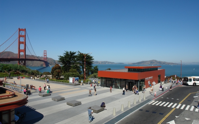
The Bridge's Welcome Center offers merchandise and historical information. Open daily from 9:00 a.m. to 6:00 p.m., the Welcome Center is the first on-site center dedicated to telling the stories of the Golden Gate Bridge. The Center welcomes visitors, provides orientation and information services, houses exhibits, and offers high-quality commemorative and interpretive merchandise, and also showcases the original 12-foot stainless steel Bridge "test tower" used in 1933. Be sure to also check out the Golden Gate Parks Conservancy online store for one-of-a-kind gifts and collectibles. Contact the Welcome Center at 415-426-5220 or customerservice@goldengatebridgestore.org.
Onsite Exhibits
Learn about the history, science, and engineering of the Bridge's construction through interactive and stationery exhibits. Wander through the Plaza just outside the Welcome Center and follow the pathway into an old bunker that houses some of the exhibits.
For a virtual version of these exhibits, go to the Exhibits section of our website.
Free Walking Tours
If you're interested in the history of the Golden Gate Bridge, twice-weekly (Thursdays and Sundays) free walking Bridge tours are offered by San Francisco City Guides, a non-profit organization associated with the San Francisco Public Library. For more information and a schedule of their walks, visit the San Francisco City Guides website.
Equator Coffee now at the Round House
The Round House is now Equator Coffee. Enjoy a steaming cup of coffee with beautiful views!
Hike and Explore
Both ends of the Bridge touch the Golden Gate National Recreation Area. Enjoy picturesque trails and vista points in one of the world’s largest national parks in an urban area. Visit the Parks Conservancy website or National Park Service-GGNRA website to begin your adventure.
Also, be sure to check out the new Golden Gate and Pacific Overlooks near the Bridge.